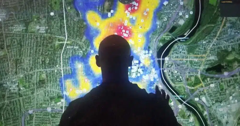
In the fast-paced world of law enforcement, having access to real-time information can make all the difference in ensuring public safety and effective crime prevention. To address this critical need, Live Earth has emerged as a game-changing solution, providing law enforcement agencies with a powerful tool for managing visual data in real time. In this article, we will explore how Live Earth empowers lives with its advanced mapping software, offering enhanced situational awareness, streamlined coordination, and vendor-agnostic tools.
Enhanced Situational Awareness with High-Speed Alerts
In the lives of law enforcement, every second counts. Live Earth equips agencies with a cutting-edge platform that delivers high-speed alerts, enabling officers to respond rapidly to unfolding situations. By consolidating data from various sources into a centralized visual display, Live Earth ensures that critical information is not lost in the noise. This enhanced situational awareness allows for more effective decision-making and ultimately, saves lives.
Heightened Comprehension and Eliminating Overload with Live Layers
Information overload can be a significant challenge for law enforcement professionals. Live Earth addresses this issue by providing live layers, which allow officers to customize their view based on specific needs and priorities. This dynamic feature enables law enforcement to focus on the most relevant information, reducing cognitive load and increasing comprehension. Whether it’s video verification, monitoring traffic patterns, or assessing potential threats, Live Earth’s live layers revolutionize how data is processed and interpreted.
Accelerated Coordination with Inter-Agency Operability
Collaboration between different agencies is crucial for responding effectively to emergencies and managing complex situations. Live Earth facilitates accelerated coordination by offering inter-agency operability. This means that multiple agencies can seamlessly share and access visual data through a unified platform. Whether it’s local law enforcement, fire departments, or emergency medical services, Live Earth ensures that everyone involved has access to the same up-to-date information, enabling a synchronized and efficient response.
Eradicating Customer Lock-In with Vendor-Agnostic Tools
Vendor lock-in can be a significant concern when adopting new technology. Live Earth addresses this issue by providing vendor-agnostic tools. This means that agencies are not tied to a specific hardware or software provider. Thus, giving them the flexibility to integrate Live Earth into their existing infrastructure. Live Earth empowers agencies by eliminating customer lock-in, allowing them to choose the best solutions for their unique needs. This ensures a seamless and cost-effective implementation.
After Action Incident Reviews
Accurate data analysis of police response and positions is crucial in after action incident reviews. Live Earth surpasses conventional mapping tools by offering historic time series replay capabilities tailored for review purposes. This feature empowers investigators to analyze the data of police response and positions, ensuring a detailed and precise representation. Response teams can bolster their analytical prowess by harnessing this advanced technology. This leads to more effective assessments and actionable insights for future incident response and mitigation strategies.
Conclusion
Live Earth’s advanced law enforcement mapping software represents a significant leap forward in real-time information management for law enforcement agencies. By offering enhanced situational awareness, streamlined coordination, vendor-agnostic tools, and intuitive evidence collection, Live Earth empowers agencies to respond more effectively to emergencies and prevent crimes. With its innovative approach to visual data management, Live Earth is reshaping the future of public safety, ensuring a safer and more secure environment for communities worldwide. Contact us today to schedule a call with our team of experts.

