The telecommunications industry is highly competitive and constantly evolving. Challenges ranging from network security concerns to a growing demand for stronger customer service can threaten telecom companies that don’t take the right steps. To stay ahead of competitors, industry leaders need to take advantage of the tools at their disposal. One of the most powerful tools — that often gets overlooked — is geospatial data analysis.
Telecom companies can use the location and geospatial data they collect to gain valuable insights into their businesses and the broader environments in which they operate. Even if you’re already collecting geospatial data, however, you still need a place to store it in order to unlock the value kept in that data. That’s where a database for geospatial data comes into play.
What is a Database for Geospatial Data?
A geospatial database is a type of database specifically optimized to store and query geospatial data. That raises the question — what is geospatial data? Geospatial data, sometimes just called spatial data” is any data that ties a piece of information to locations on the Earth’s surface. If your data has something to do with a specific location on Earth, that’s geospatial data. Some examples of geospatial data include traffic and accident data by location, weather data, and population density.
Traditional databases aren’t equipped to efficiently store, index, and query geospatial data. Any company interested in collecting and using geospatial data will need a database for geospatial data to do so.
Why Geospatial Data Matters
Geospatial data has a variety of powerful applications, especially when combined with more traditional business data. By analyzing traditional data and geospatial data together, telecom companies can gain insights into complex interactions and relationships as they relate to locations.
Say you’re trying to identify current trends in demand in the telecom industry, for example. If you look at non-spatial data, you’ll just see the general trends across the whole area where you collected data. With geospatial data, by contrast, you can tie your consumer demand data to specific locations. Is demand rising quicker in cities or more rural areas? Which areas are experiencing the largest growth in demand? Geospatial data analysis can help you answer questions like these. And with those insights, you can develop more informed strategies for your telecom business going forward.
Benefits of Geospatial Data in Telecommunications
Telecom companies that use geospatial data can apply this information in many different ways, including:
Rolling Out New Networks
When you provide telecom services, you don’t just have to worry about what’s happening now. You always have to keep an eye on the future and the “next big thing.” A recent example in the industry is 5G networks. The arrival of this new technology left telecom providers scrambling to find ways to roll out new networks in a cost-effective way while maintaining their existing infrastructure.
Telecom providers can use geospatial data and geospatial analysis to facilitate the design and rollout of new networks. This data offers them insights into service areas that they would otherwise lack. They can learn about the population density, terrain, topography, and other key details of each service area. A complete understanding of the various service areas into which a telecom provider expands or upgrades is a huge advantage.
Improving Network Performance
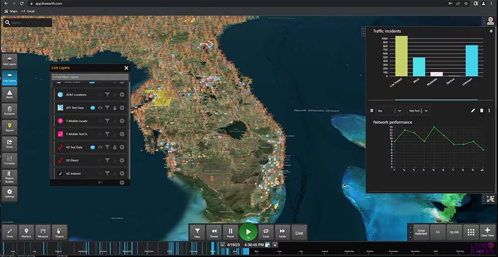
Any telecom professional can tell you that network performance is closely tied to usage in areas across the country. If you don’t have access to geospatial data that breaks down network performance by location in detail, though, your telecom company will struggle to improve that performance. Geospatial data analysis will allow you to break down location-based network information and find areas where you can make improvements.
Inevitably, some of your existing network structures will eventually need maintenance and operation. You can use a database for geospatial data to track and organize the maintenance history for all of your network components. Through visualizations of this data, you can even easily view each of those components on the map. All your location-tied network data will be in one convenient place, making the task of improving network performance much more manageable.
Finding New Opportunities
For telecom providers to succeed long-term, they always need to be on the lookout for great new opportunities. There are many different ways to do this, and geospatial data analysis is one great option. Telecom companies can use geospatial data to monitor consumer preferences and behavior to pinpoint new opportunities as they arise. This data is an excellent foundation for more comprehensive market analysis as well. If you don’t want your competitors to identify and take advantage of new opportunities in the market before you do, you need to use geospatial data analysis.
Offering better customer service
Telecom customers today have many different providers to choose from. One of the ways they differentiate between telecom providers is by comparing the levels of customer service they offer. In other words, your telecom company needs to provide great customer service if you want to stay ahead of your competitors. Geospatial data analysis can help you do just that.
Your geospatial data can, for instance, alert you to an increase in customer service requests from consumers in a particular area. This information would help you quickly resolve the issue and ensure your customers are happy with the level of service you offer.
Transform Your Telecom Enterprise with Geospatial Data
If you aren’t already using geospatial data in your telecom enterprise, now is the time to start. With a database for geospatial data, you can collect and analyze insight-rich geospatial data to ensure you outmaneuver the competition. Live Earth is a platform made to help telecommunications companies see the big picture with real-world geospatial data analysis.
Use Live Earth to create detailed data visualizations of geospatial data that drive better business decision-making. You’ll have faster, more comprehensive analytics at your fingertips, giving you unprecedented control over your network. Schedule a demo to see Live Earth in action and start accelerating your business intelligence.