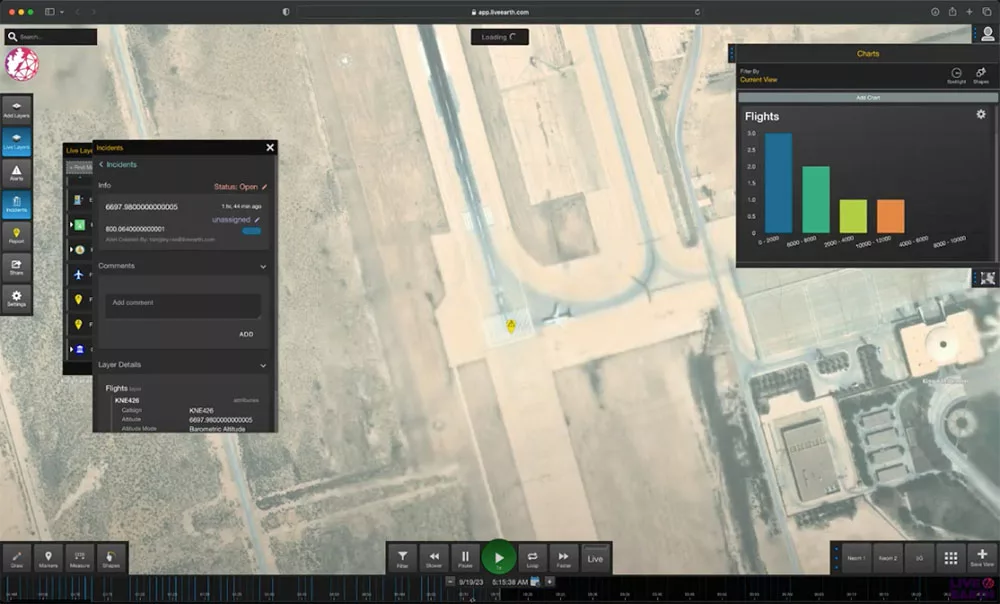
In today’s rapidly evolving world, industries reliant on logistics and transportation face the challenge of managing vast amounts of data to ensure efficient operations. The Live Earth Data Platform emerges as a game-changer in this arena, offering real-time access to geospatial, machine learning, and anomaly detection capabilities. In this article, we’ll explore the specific use case of Flights and Shipping, and how Live Earth empowers teams to harness the full potential of their data.
Data Sources, Geofences, and Advanced Filtering
Data Sources
Live Earth integrates a diverse range of data sources, providing a comprehensive view of the operational landscape. These sources include:
- ADS-B Feeds: Live Earth incorporates real-time flight data from ADS-B transponders. This data includes information about aircraft such as location, altitude, speed, and more.
- AIS Data: For shipping operations, AIS (Automatic Identification System) data is vital. It offers real-time information on vessels, including their location, heading, and speed.
- Weather Data: Weather conditions play a crucial role in both flight and shipping operations. Live Earth pulls in meteorological data to provide a holistic view of environmental factors.
Geofences
Geofences are virtual perimeters defined on a map, allowing users to establish boundaries and trigger alerts or actions when specified conditions are met. In the context of Flights and Shipping, geofences can be employed in various ways:
- Port Zones: Define geofences around ports to monitor vessel traffic, thus ensuring compliance with regulations and optimizing operations.
- Restricted Airspace: Establish geofences around restricted airspace areas, enabling real-time alerts for unauthorized entry or potential security breaches.
- Flight Paths: Designate specific routes as geofenced areas to monitor aircraft movement and deviations from planned trajectories.
Advanced Filtering
Live Earth offers advanced filtering capabilities, allowing users to refine data streams based on specific criteria. For Flights and Shipping, this can include:
- Altitude Filters: Zero in on flights or vessels within specific altitude ranges, optimizing data relevance for different operational contexts.
- Speed Thresholds: Filter vessels or aircraft based on their speed, ensuring focused monitoring of relevant segments.
- Time Windows: Define time-based filters to view data within specific periods, enabling historical analysis or real-time tracking during critical phases.
Using Geopolitical Boundaries as Geofences
Live Earth leverages geopolitical boundaries to enhance geofencing capabilities. This feature enables users to create geofences based on political or administrative boundaries. For example:
- Country Borders: Monitor cross-border movements of vessels or aircraft, ensuring compliance with international regulations.
- State/Province Lines: Establish geofences around specific states or provinces to facilitate regional tracking and analysis.
- Custom Administrative Areas: Define custom administrative zones for specialized monitoring requirements, such as exclusive economic zones (EEZs) for maritime operations.
Data Source Advanced Filtering
Live Earth’s advanced filtering capabilities extend to individual data sources. This means that users can apply specific filters to different types of data feeds. For instance:
- Aircraft Type Filters: Tailor the view to specific aircraft types, allowing for specialized monitoring of different classes of aircraft.
- Vessel Class Filters: Focus on particular types of vessels, such as cargo ships or fishing vessels, for targeted shipping analytics.
- Environmental Condition Filters: Integrate weather data to filter flights or vessels based on prevailing conditions, ensuring safety and compliance.
Conclusion
Live Earth Data Platform revolutionizes the Flights and Shipping use case by providing a powerful suite of tools for data integration, geofencing, and advanced filtering. By leveraging diverse data sources and geopolitical boundaries, teams can gain unparalleled insights and optimize their operations in real time. With Live Earth, the sky is not the limit—it’s just the beginning.
For more information on how Live Earth can transform your operations, contact us today.

