The World Health Organization declared the Coronavirus (COVID-19) a pandemic. More than 213 countries and territories have reported cases. Additionally, the total number of global cases reaches 7,647,000+, with 425,000+ deaths as of June 12, 2020.
Watch LIVE UPDATES from the World Health Organization on COVID-19
In the US, Coronavirus has taken the lives of 116,000+ people, and 2,094,000+ people have confirmed cases of COVID-19 in all 50 states.
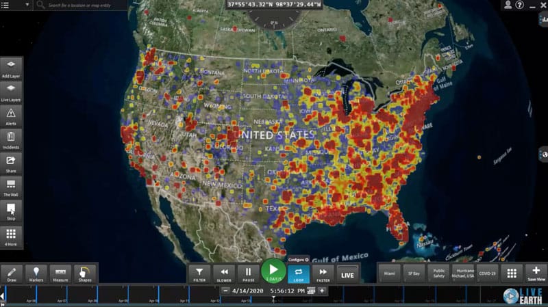
*The video heat map represents the spread in the US from February 18 to April 24, 2020.
With this heightened level of risk, Live Earth integrated live data visualization layers from data feeds at Johns Hopkins that update daily at 19:00 CST. Organizations can see the spread of the virus and set real-time alerts within the platform. These alerts will notify their security operations of new reported cases allowing them to make real-time adjustments. Thus, keeping travelers or their facilities and/or on-site employees that could be impacted by the spread of COVID-19.

Real-Time Client Example:
- Ingest physical locations of all of your facilities with your own data
- Track flights associated with employee travel
- With our geofencing security software, create a shape around all of your physical locations or the locations your employees are traveling to and from
- Set custom real-time alerts when new cases of COVID-19 are reported that come within a specific distance of a facility. As a result, flight destination or employee location will have increased situational awareness at all times
- Continue to monitor the spread of COVID-19 in the USA through the live data visualization layers within the platform
Learn how organizations, cities, states and government authorities are leveraging this data as well as other valuable data sources to uncover patterns and trends to make decisions faster and help flatten the curve. Contact Live Earth today to schedule a consultation.
Spread the Word to Help Flatten the Curve

